Pictures (takes a little while to load)


Main Features
A meandering walk from the mining hillside of Todmorden Moor through small hamlets to standing stones, past a once “stately home” dropping down to Centre Vale Park and the town centre.
Gradient
No strenuous uphill sections. Steeper parts are downhills, such as after Stones, and through the beech wood towards the end.
Terrain
Relatively easy. Possible sections of mud particularly after prolonged rain.
Obstacles
Gates, stiles, steps. Grazing cattle on public access areas and footpaths should not normally be a problem.
Facilities
None. Take own refreshments.
What to take
Waterproof walking boots. Appropriate seasonal clothing for wind on the moorland section; possibly a walking stick for downhill sections.
Description
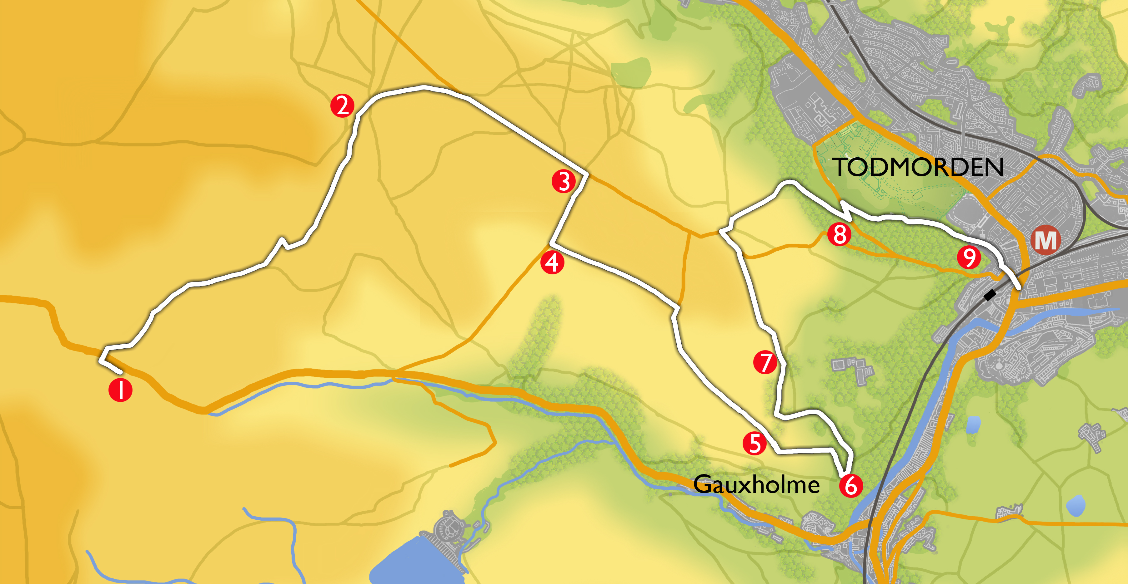
Take the 465 Rawtenstall bus from Todmorden Bus Station and ask for the stop on Bacup Road after the Astronomy Centre (Second “Holden Gate” stop). Note: there is no bus service on Sundays.
-
 Cross the road and take the track signposted public bridleway and Todmorden Centenary Way, to the right of two white painted cottages. After 380m fork to the right at a yellow topped post marked Todmorden Centenary Way. The path here becomes indistinct, so head very slightly to the right of the nearest wind turbine until a yellow topped post can be seen. Follow the yellow topped marker posts, which become blue topped Centenary Way posts. From this path good views are obtained of the observatories down below on the right. The wind turbines were installed on Todmorden Moor in Spring 2014.
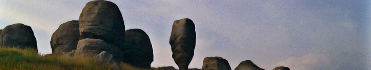
The White topped posts are markers for the Todmorden Moor Geological and Heritage Trail. Information boards can be seen. This moorland has a rich history of coal mining, clay extraction and stone quarrying. Fossils and worked flints have also been found here.
Continue to follow the blue topped posts around the contours of the moor, crossing a small stream, with views of Cloughfoot hamlet down in the valley, Stoodley Pike on the horizon, and ahead and just to right Sourhall settlement.
Birds you are likely to see or hear on the moorland include the skylark with its high ascending flight and cascading song, meadow pipits, and the distinctive piping call and down-curved bill of the curlew.
-
On reaching a track, turn right and ignoring a path on the left continue along the track to reach a tarmac road at the start of the Geological Trail. There is an interpretation board for the Todmorden Moor Geological and Heritage Trail at the junction with the road, and another separate panel about the giant Stone crushing wheel 130m before this on the left. Turn right and continue down the road to the small hamlet of Sourhall.
-
After crossing a cattle grid (or passing through the gate) turn right on to Sour Hall Road.
The cottages on your left were built in 1840 as a “picker works” but in 1874 after a smallpox epidemic were bought and converted into an isolation hospital, with local worthies, such as Samuel Fielden contributing to the funding. Contributions also came from Bacup and Hebden Bridge.
-
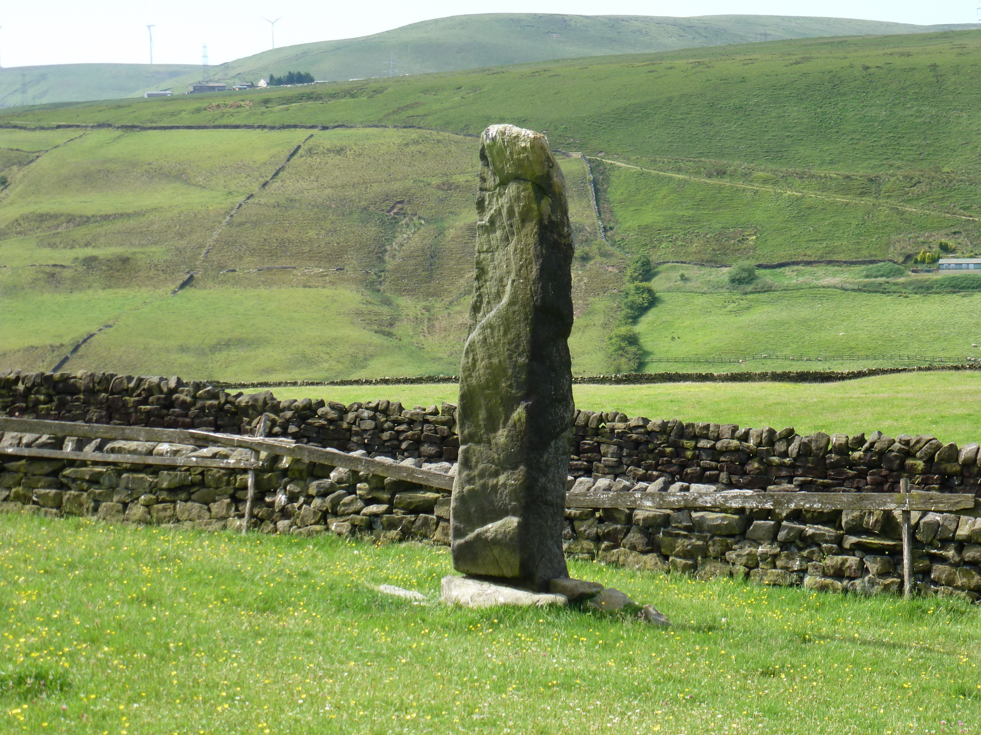
After 400m at Moor Hey, turn left at the public bridleway signpost. After passing through the yard continue through several fields and gates, keeping the stone wall on your right,until you reach another road (Stones Lane). Turn right. After passing a substantial farm on your left (Stones Grange Farm) the first of the standing stones can be seen ahead towards the end of the field on your right, at a modest 1.5m in height. The second and tallest stone, an impressive 4-5m high can be seen just to the left of the road and the third stone to the left, higher up, amongst some trees at the top of the field just above a stone wall corner.
The history and age of these standing stones is speculative. Another stone may have stood near to the first one just after the farmhouse, but it was uprooted and a spring appeared. The third stone, among the trees, may have been erected at the beginning of the nineteenth century. The tallest stone may have been reset in a slightly different place from where it originally stood, but nevertheless is still an excellent specimen.
-
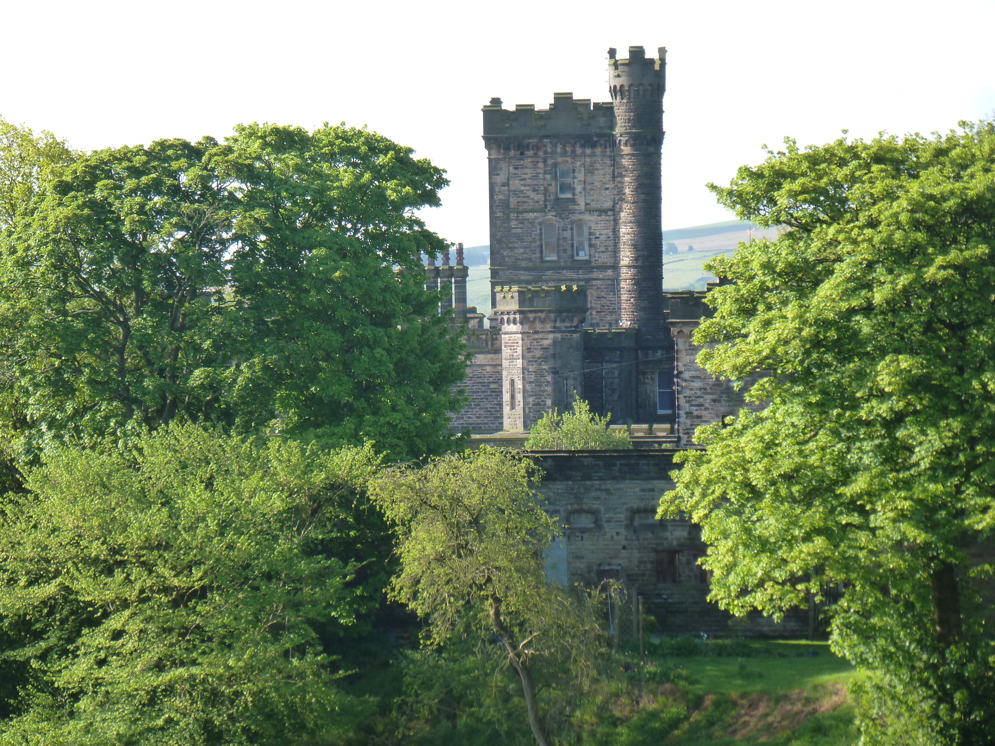
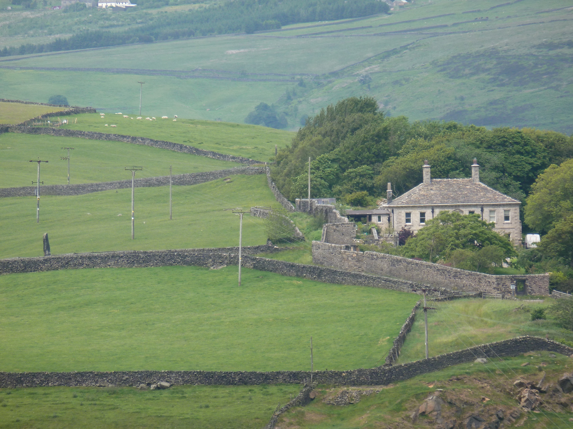
On reaching the little hamlet of Stones continue straight on the road (no through road) passing a substantial stone wall around a house and garden. Pass between two posts on to a walled grassy path marked Todmorden Centenary Way Link Path, with a transmitter mast on your left. As the path bends right, over the left hand wall is Lob Quarry. This quarry provided stone for Dobroyd Castle (which, depending on the season can be glimpsed beyond the quarry), and the railway viaduct in Todmorden town centre.
-
Start to descend and when the wall on left ends take the signposted path on the left down the grassy hillside, with the Rochdale Road valley below on your right. After a short steep descent down some steps you come out onto another road (Stones Road). You are on the Calderdale Way,a way marker symbol is painted on the wall to your left, by a grit box. Go left, uphill, passing the entrances to Lob Quarry and Pex House, with views of Dobroyd Castle to your right.
Dobroyd Castle was built by John Fielden, son of “honest” John Fielden between 1866 and 1869. The architect was John Gibson who also designed the Unitarian Church(1869) and Town Hall(1875) in Todmorden, and the grounds were laid out by Edward Kemp. The Castle was a family home to the Fieldens until it was sold to the Home Office in the 1940’s. Since then it has been an Approved school, a privately run residential school, a Buddhist Centre and a Children’s Activity Centre.
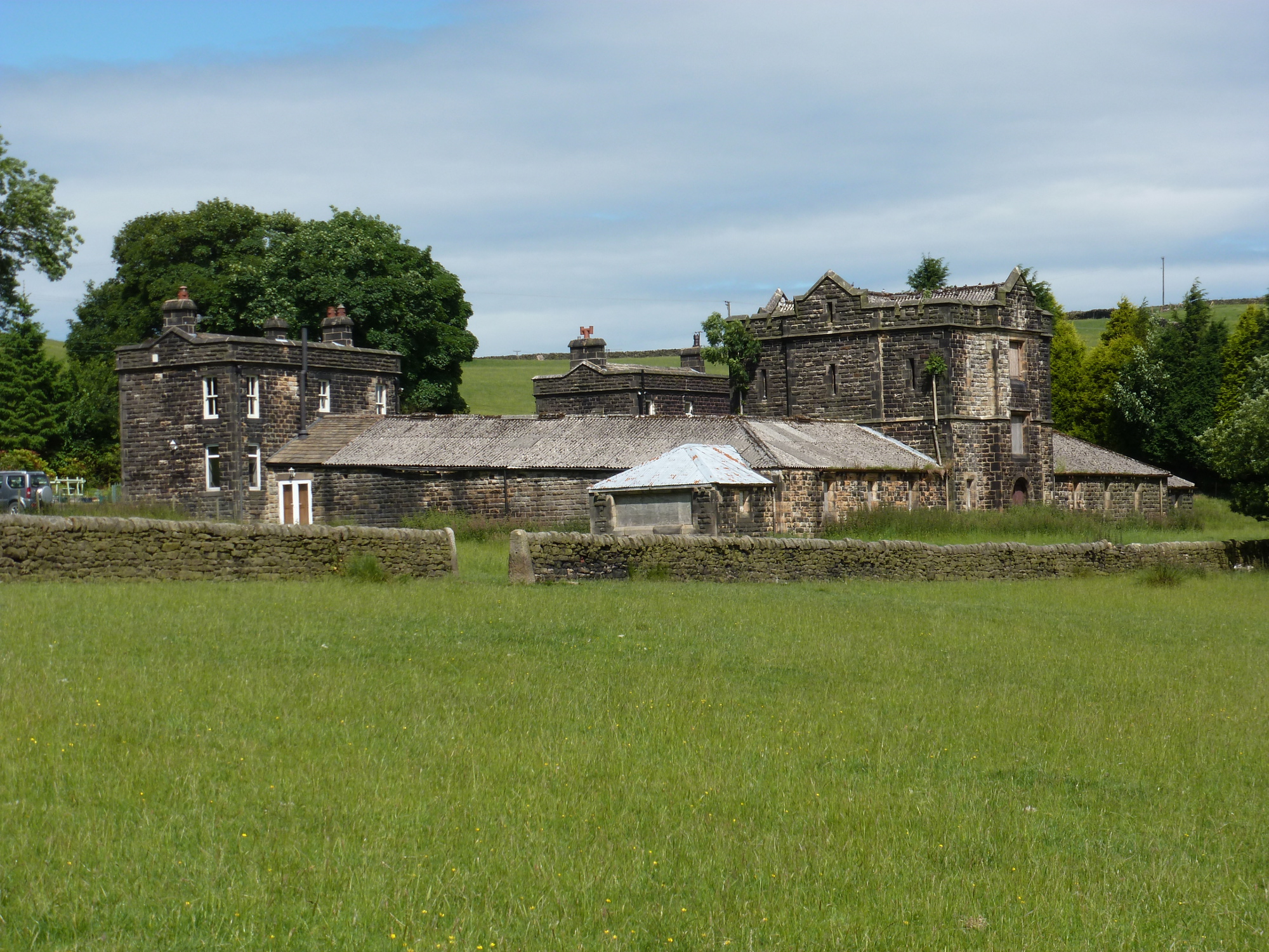
Continue along the track until the gates to Stones hamlet are on your left. Bear to the right on to a grassy track following the sign for the Calderdale Way. The other side of the third standing stone can now be seen on the left. The substantial buildings on the right were the model farm built to serve Dobroyd Castle.
-
After the next house (Ping Hold) cross the stile and bear left, uphill away from the stone wall on the right, still on the Calderdale Way, with views of Todmorden centre down to the right. The house just below on the right is Edge End, the birthplace of “Honest” John Fielden. Continue through three fields to reach a road. Turn left. After 130m, at the junction turn right and follow the track round to the left passing the sign for Kaley’s Barn. Take a grassy path on the right just before the next house, signposted Calderdale Way running downhill between walls, with views of Stoodley Pike to the right and Whirlaw Hill ahead. Cross a stile, keeping a stone wall on your right. After a kissing gate with Calderdale Way and Todmorden Centenary Way Link Path signs, the path bears to the right and then follows a long fairly steep (slippery when wet) descent through a beech wood.
-
At the road, turn left and after 100m turn sharp right along a wide track signposted Calderdale Way Link path. Continue along this track which becomes tarmacked (Lovers’ Lane), above Todmorden Centre Vale Park. You pass the ruins of Carr Laithe the original home of Ruth Stansfield who married John Fielden the builder of Dobroyd Castle. (You have the option of taking any path down through the park to reach the Burnley Road where you turn right and continue to the town centre.) Continue on Lovers’ Lane to meet a cobbled pathway running down the hill.
-
Turn left and follow the cobbled path down towards the old Christ Church. At the end of the cobbles take the stone steps down with Christ Church (now a private home) on your left. The building on your right is the old vicarage, scene of the infamous murder of 1868.
This was a revenge killing by Miles Weatherill who had been forbidden to see his sweetheart, Sarah Bell, by the Reverend Anthony Plow who employed Sarah as a cook. Weatherill, armed with an axe and pistols attacked and killed Jane Smith, employed as a nurse in the vicarage, and attacked Reverend Plow who died a week later. Weatherill was found guilty and duly hanged, – the last public execution in Manchester.
Continue along this track to the Burnley Road; turn right to return to the bus station and town centre.