Main features of the walk
A far-ranging varied walk with open views of moorland, farmland and hamlets, steep wooded valleys. The canal towpath takes you back to Todmorden.
Length of walk and time
12.5 km ( 8 miles) 4+ hours
Gradients
Gradual ascent and descent
Terrain
Well-signed tracks: sandy, stony and sometimes muddy.
Obstacles
Gates
Facilities
Some benches. No refreshments – take water and a snack
What to wear/take
Sturdy footwear, warm/windproof tops
Description
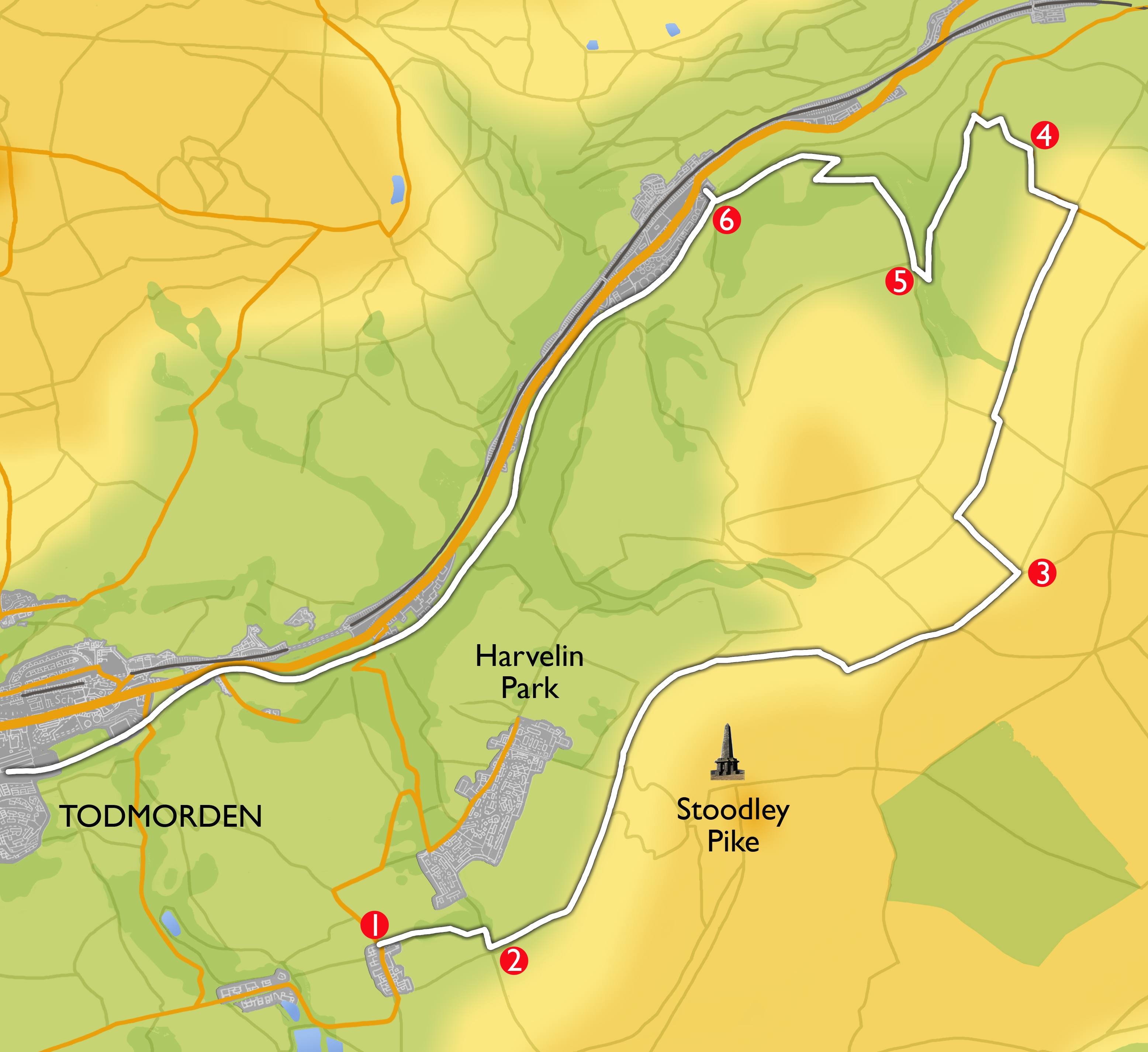
Take the T6 or T8 bus from Todmorden Bus Station and ask the driver to drop you off at the Mankinholes YHA Hostel (the stop is officially called ‘Sisley Lane’).
-
Set off along track to the side of the Youth Hostel heading towards Stoodley Pike in the distance. After 400 m, turn right at the cross roads opposite the entrance to Broad Carr Farm. Just before the next house on the right look out for the dragon on the end of their stone barn roof and just after this house over the wall on the right is an unusual outdoor chess board all set out ready to play. At the top of the slope go through the metal gate and turn left on the track which is the Pennine Bridleway.
-
This track is known locally as the London Road and is an ancient packhorse route. You will continue on this track for about 2.5 km.
You have now entered Langfield Common, an extensive area of upland moorland that has been designated a Site of Special Scientific Interest for its flora and fauna. There is a convenient bench here just above the track where you can rest to take in the view.
The track skirts below Stoodley Pike and at 1 km there is another bench on your right at the junction with the Todmorden Centenary Way. After another 1.5km go through a gate and continue to where it crosses the Pennine Way by a wooden fingerpost. After 20 m, go through a second gate by a farm building.
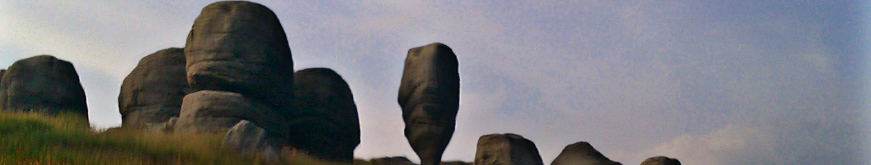
This is the highest point on the walk with splendid views opening up ahead of Heptonstall with its distinctive church tower on the other side of the Calder Valley.
You are now on a walled track called Kilnshaw Lane. You may hear and see curlews on the moors to your right
-
After 400m, turn left on a track waymarked the Pennine Bridleway. After 500m, before reaching the farm at the end, turn right onto the field edge track signposted PBW. You follow this wide path (Pinnacle Lane) for 2km. Continue on through a gate/stile to follow the stone flagged route between stone walls. After 1km, at a farm gate, ignore a left turn signposted PBW and go straight ahead. There is a short stretch of path here which is likely to be very wet with puddles and mud, and you may have to tiptoe over convenient stones before regaining a firmer stone flagged path. You pass a house on your left and come out at T junction with a tarmac road (Broad Lane). Turn left down the hill to Horsehold hamlet. Heptonstall church tower is a focal point in the view ahead the other side of the Calder valley.
-
At the T Junction and Horsehold Farm, turn left through the hamlet and after 50 m, where the road bears right turn sharp left heading through a wooden gate. Follow this splendid path along the top of Horsehold Wood. After 500m you reach a junction with the Pennine Bridleway, take the right fork, cross the bridge over the stream in Beaumont Clough and climb up to a wide track which is both the Pennine Way and the Pennine Bridleway.
-
Turn right down the track, continue downhill through Callis Wood, ignoring lesser paths to the right and left. After 750m you begin a zig zag past Callis Wood Farm (or you can take the short cut, signposted Pennine Way). After 500m you reach the Rochdale Canal at Callis Bridge.
-
Cross the canal bridge, turn right, and looping back under the bridge take the canal towpath, past the water treatment plant and all the way to Todmorden (4.5 kms). An alternative is to walk on to the main road and to catch any of the Calderdale valley buses back to Todmorden from the bus stop 50m to your left.